
Marine
News from MSI: Seal Usage Maps Update
January 16, 2014 by Andronikos Kafas No Comments | Category Marine Renewables
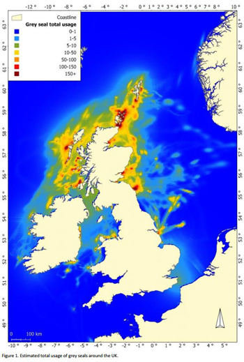
Estimated total usage of grey seals around the UK
A technical problem was found with the data in the seal usage maps in August 2013 and since then the maps have been unavailable through MSi. These maps have now been updated and the version that is available has had this error corrected. If you have previously downloaded the seal maps, please now update your files with the current version on the website. If you have any questions or concerns about the use of the maps, please contact Kate Brookes: Kate.Brookes@scotland.gsi.gov.uk.
The maps will be updated from time to time as new data become available. When this happens, we will email users who have registered with us. Please consider registering your email address with the MSi updates mailing list so we are able to keep you up to date.
Access MSi at http://www.scotland.gov.uk/Topics/marine/science/MSInteractive
Article by Dr. Ian Davies

 RSS
RSS Email
Email
Leave a comment